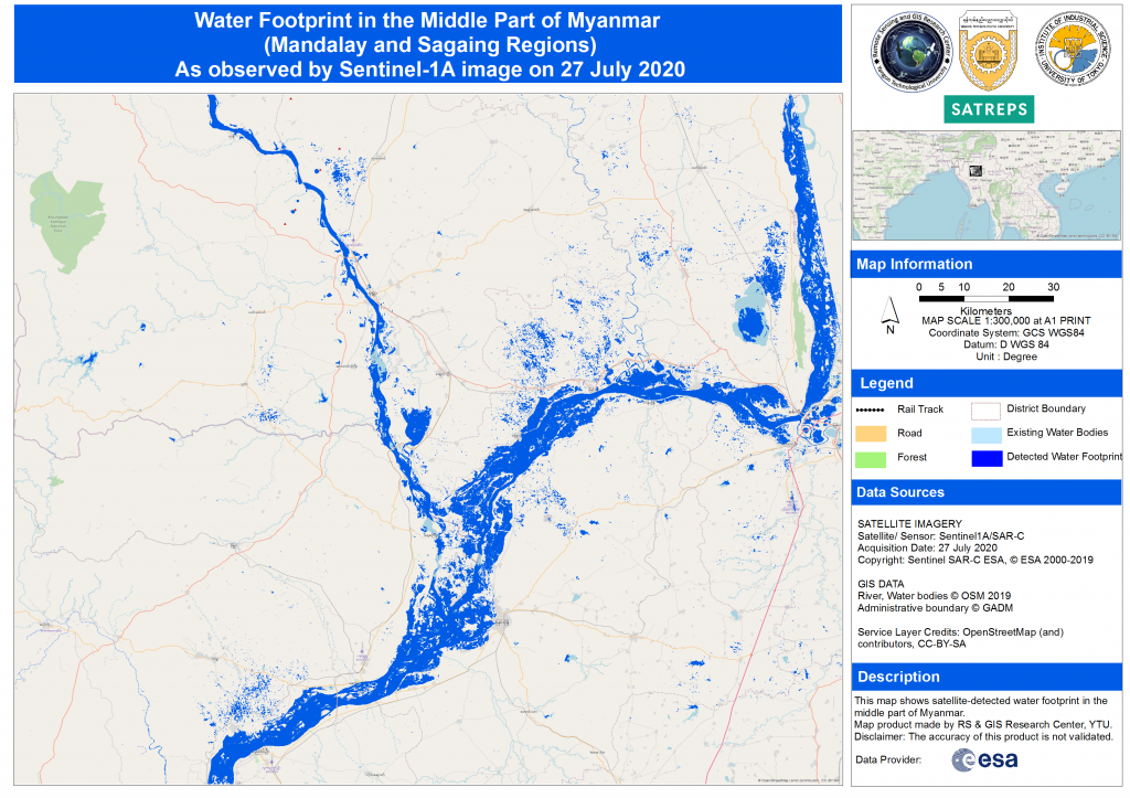
Water footprint the Middle part of Myanmar, 27th July, 2020
A flood map created by using Sentinel 1 SAR in collaboration with Yangon Technological University (YTU) RS/GIS Center for the flooding that occurred in Mandalay region of Myanmar on July 27, 2020, is now available.